
This post, and posts like it, is an attempt to make real-life geological phenomena more accessible to a rising generation of tech-savvy, gaming youth. Studies have shown that there is room in education for the use of virtually created worlds from video games to teach real-world geology and other scientific processes. One particular study of interest can be found here. I do own the rights to most of the images in this post, but the story and geology explained in this post comes from real-world phenomena and is not directly linked to actual Legend of Zelda lore. The characters, locations, and scenes come from the popular video game The Legend of Zelda: Breath of the Wild and I do not take credit for them. I hope you enjoy my creative scientific interpretations!
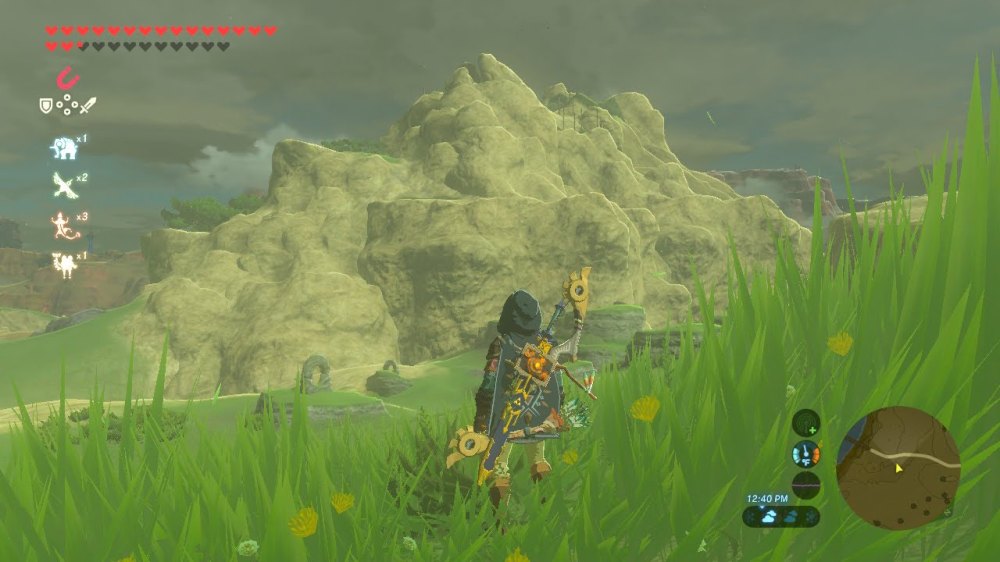
From the desert sandstone of the Gerudo Highlands to the volcanic rock of Death Mountain, Hyrule has some breathtaking geologic features. I’m Strade, your friendly travelling Goron Geologist and I will be your guide through this beautiful portion of Hyrule. Today, we are going to be solving a geologic mystery–how did the rocky rings near the Western plains of Hyrule form? So grab your climbing boots, and maybe a Snowquill Tunic to stay warm and dry, and we’ll unravel the geological phenomena that is the rocky rings.
The Rings
Make Some Observations!
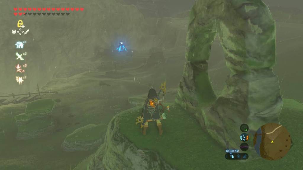
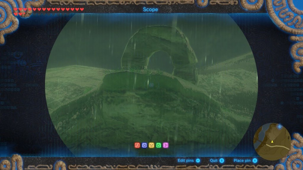
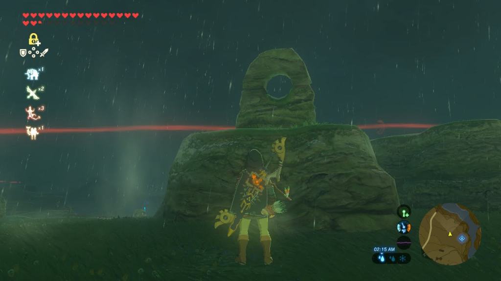
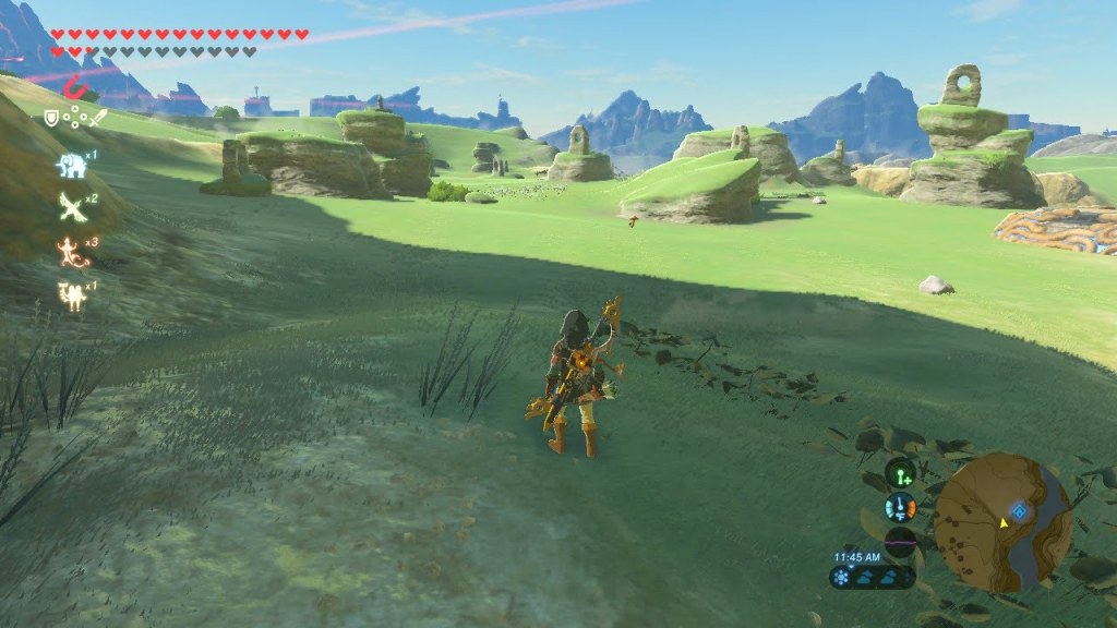
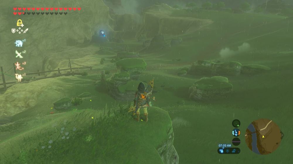
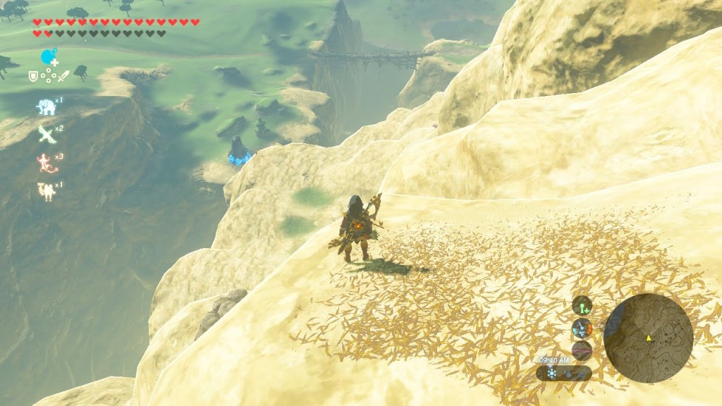
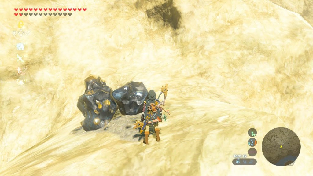
Click through the image gallery below. Put yourself in Link’s shoes and look all around you. Write down your observations, no matter how small! Here are some questions to guide your observations:
How would you describe the rings? What about the rock around the rings?
What do you notice about the landscape around the rings?


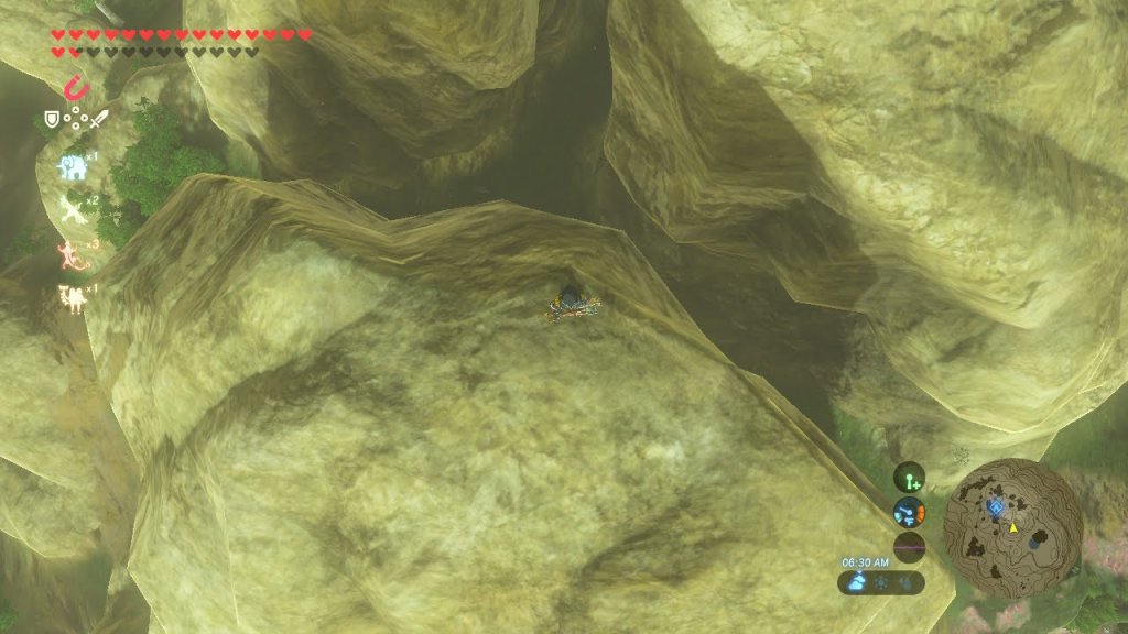
Like any good story, it all starts long ago, and I mean a LONG time just like any good rock formation takes to form. Think older than the ancient Sheikah monks that watch over the shrines, like millions of years older than them! Back then, the Faron Sea covered the entire land of Hyrule. The climate remained cool for thousands of years and so the sea remained, depositing layers and layers of rock sediment and mud at the sea floor. Older layers of sediment and mud eventually formed horizontal layers of different rocks. These rings came from these some of these different rocks from this time. Eventually the Faron Sea began drying out and receded southward, exposing a lot of these sedimentary rock layers from the sea floor.

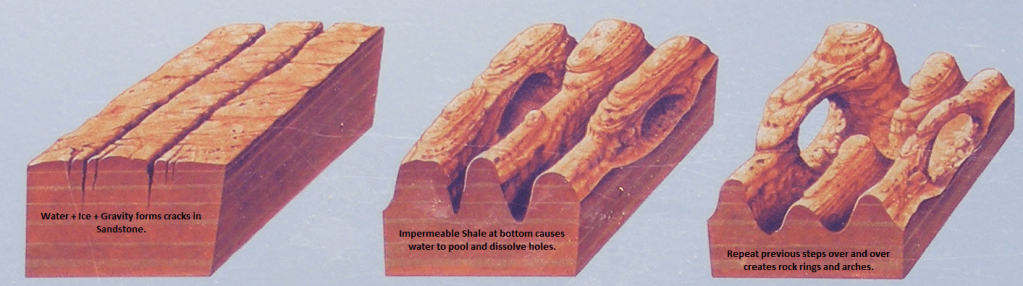
Each sedimentary rock responds differently to weathering processes like rain, ice, and wind. For example, the sandstone rock that formed the rings you see here are a lot more prone to break down with rain, wind and ice than the shale rock layers directly below the rings. The mineral calcite found in the sandstone readily dissolves in water, releasing sand grains to be washed away. A lot of calcite dissolved and, with the help of gravity, formed large vertical cracks in the sandstone. Freezing water expanded within these cracks, making the cracks in the rock even larger. But the water did not easily dissolve the shale layer beneath, so the water pooled at the base of the sandstone layers dissolving away the middle parts of the rock. Hundreds of years later, huge portions of the sandstone dissolved and eroded away leaving behind these rocky rings. Later, active plate tectonics underneath Hyrule formed a thrust fault in the area which lifted these sedimentary rock layers to the surface, exposing them to wind which continued to erode and smooth those rocky rings. Then, as pressure mounted from a different convergent plate boundary nearby, some of these sandstone and shale layers got forced higher upwards than others (imagine your friend standing on one end of a rug and you are on the other end of the rug pushing it towards your friend. You would see a lot of different rug hills!). Thus we see scattered sandstone rings at slightly different elevations and angles.
Now, if we take a step back and look again, we will notice there are still more pieces to this puzzle that need to be solved to understand the landscape we see around the rocky rings.
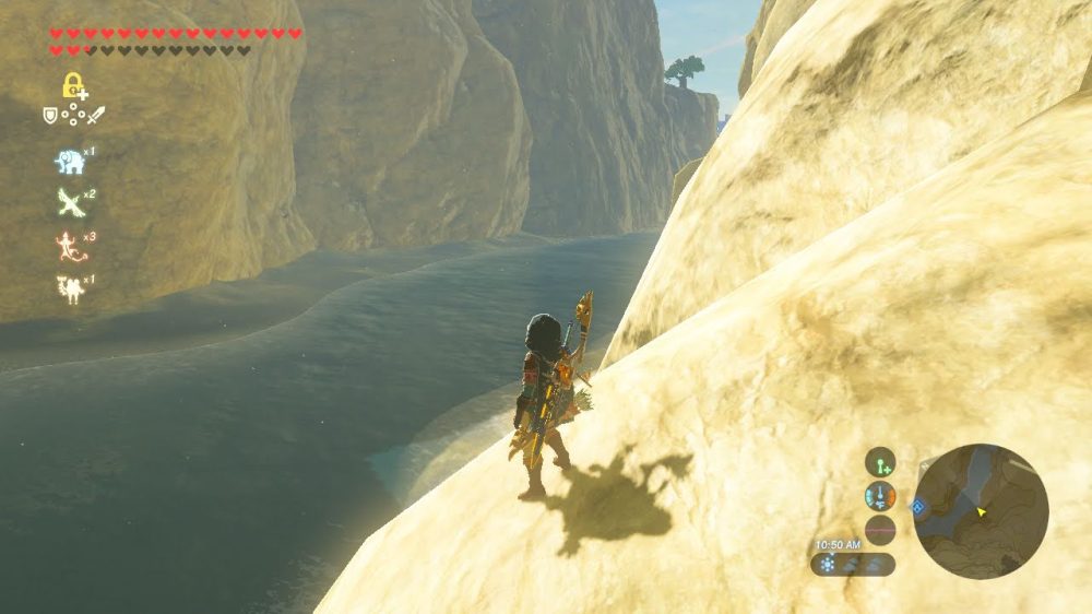
West Hyrule Plains
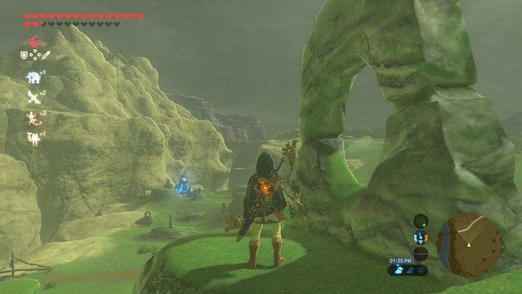
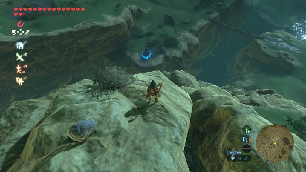
Make some observations!
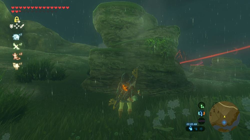
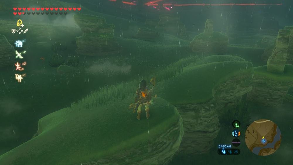
Click through the image gallery below. The area immediately around the rings is known as “West Hyrule Plains.” Put yourself in Link’s shoes and look all around you. Write down your observations, no matter how small! Here are some questions to guide your observations:
How does the shape and elevation of the land change in this area?
What geologic features do you notice nearby? Could they influence how the plains change shape?


While moving plates of land under Hyrule were lifting up these rocky rings, they were also forming the hills of the West Hyrule Plains and the Satori mountains in the nearby region. Mountains are formed as these huge underground rocky plates collide. But as the climate of Hyrule began to cool once more, water and ice was ever-present in western Hyrule. Moving water on a mountain inevitably causes landslides and avalanches. As the West Hyrule Plains were once connected to the Satori Mountains, these landslides continued to occur and form the rolling hillsides we see in the region. The rings are set in a lower valley, this is caused by the continued movement of the local thrust fault that is causing this rocky ring valley to drop. Landslide sediment continued to bury a lot of the sedimentary rock that formed these rings. Thus, more of these rocky rings are thought to exist below the sloping hills of West Hyrule Plains.
The Satori Mountains, West Hyrule Plains, and the rocky ring valley were once connected, but now they look a bit different. Let’s take a closer look at the Satori Mountains and find out what happened.
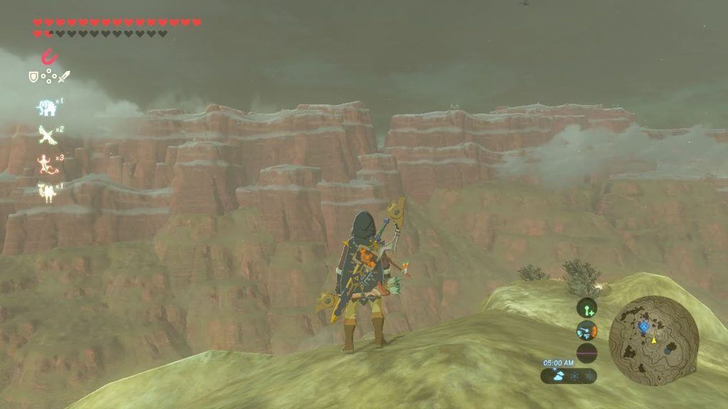
Satori Mountains
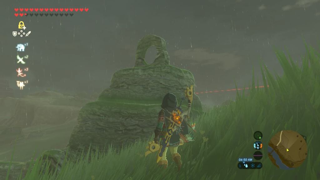
Make some observations!
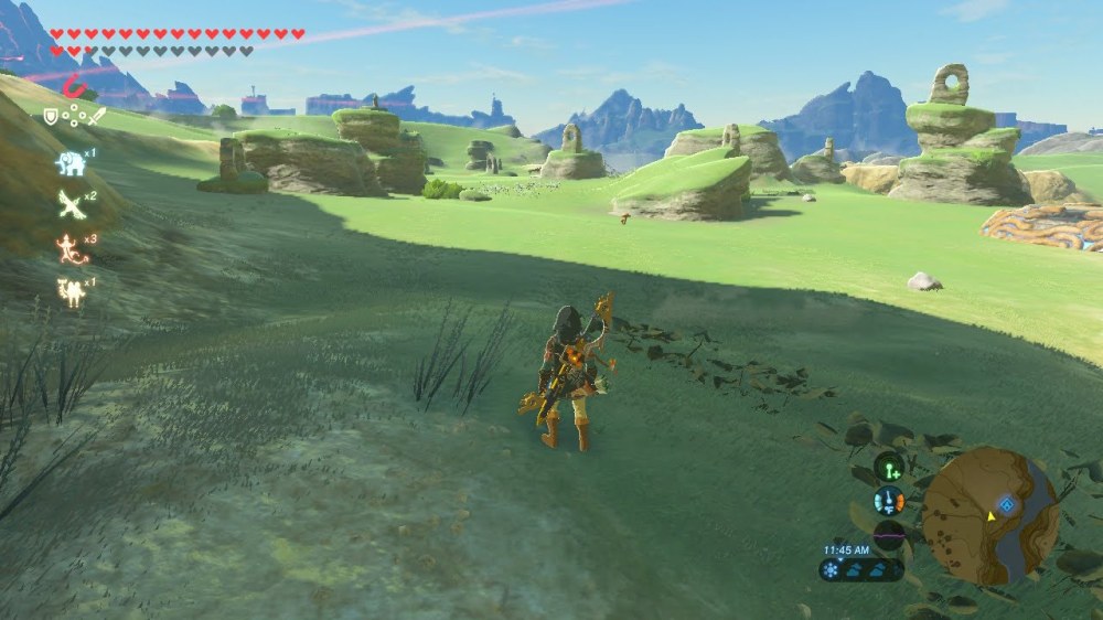
Click through the image gallery below. The nearby mountains just south of the rings is called “Satori Mountains.” Put yourself in Link’s shoes and look all around you. Write down your observations, no matter how small! Here are some questions to guide your observations:
How are the shapes and textures of the Satori Mountains different from the plains near the rings?
What other kinds of matter do you notice that could have helped shape the mountains?


The Satori Mountains were not formed by any ordinary convergent plate boundary, they were formed from a subduction zone. This zone occurs when a continental plate collides with a oceanic plate (the plate that lies just under the Faron Sea). As the oceanic plate slides under the continental plate, it creates a huge amount of heat energy known as friction. In fact, it’s enough energy to melt rock. This melted rock formed large magma chambers deep underground. As the magma chambers were lifted up by the colliding plates, they eventually cooled forming large igneous rock bodies, granite batholiths. You may have noticed the bubbly shape of the igneous rock that forms the mountain. This occurs as the cooled granite rock chunks lift up above the surface and are exposed to weathering and erosion, the same processes that formed the rock rings. Imagine taking a gigantic piece of sandpaper and smoothing our these rough granite batholiths rising into the air. Weathering is also constantly breaking off chunks of valuable minerals from the granitic rock which can be mined and harvested.
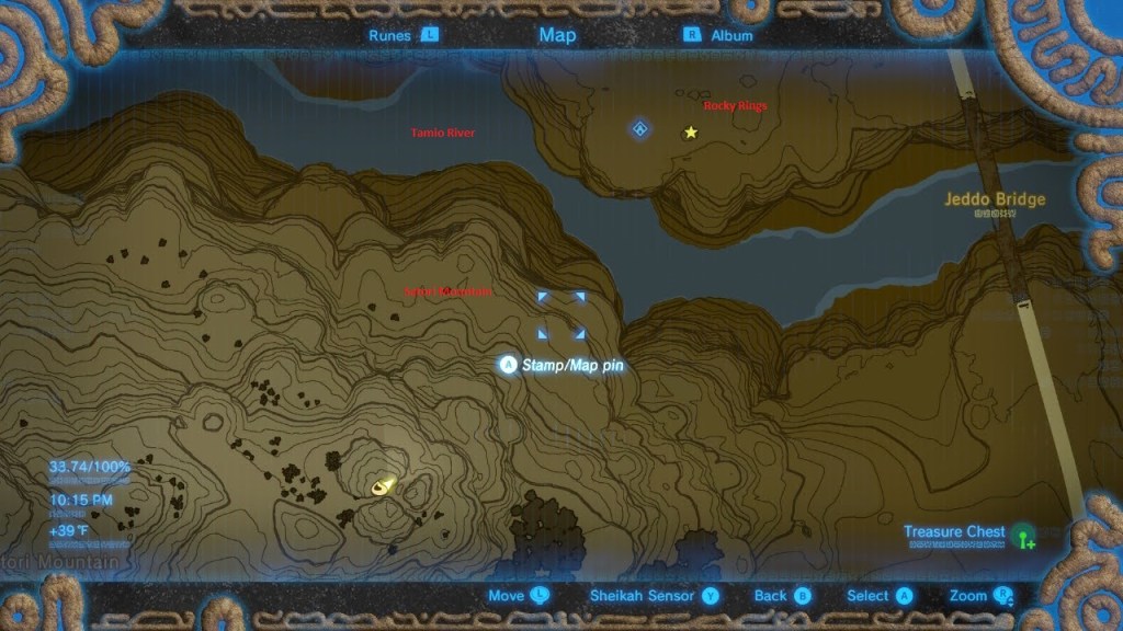
As the rings began to take shape and the Satori mountains began to rise and form, flood waters forced their way through the region from the nearby Laparoh Mesa. The rapidly cooling climate caused snow and ice to form on the distant mesa. As they melted, they rushed across the flat mesa surface and down into the Satori basin and mountain range. This high energy water movement mixed with the force of gravity created multiple cuts and channels through the region. Deep ravines from these channels are still seen in the Satori mountain, but one major remnant of the high energy floods remain. The high energy Tamio River has been cutting into the mountain for thousands of years and has since separated the Satori mountain from the rocky rings and West Hyrule Plains. But high energy winds from the newly formed canyon now help to further smooth and form the rocky rings.
Interestingly, the Tamio River has since slowed down considerably. This is because a large landslide has blocked off the flow of the river from the west side near Laparoh Mesa. This has caused the river to now flow slowly from east to west, as opposed to west to east. But the river, whether moving fast or slow, has helped to form a nice little ecosystem in the region. Let’s explore this ecosystem further.
West Hyrule Ecosystem
Make some observations!
Click through the image gallery below. The nearby mountains just south of the rings is called “Satori Mountains.” Put yourself in Link’s shoes and look all around you. Write down your observations, no matter how small! Here are some questions to guide your observations:
What kinds of living things do you notice that take advantage of the surrounding plains and the nearby mountains?
How does the climate influence the matter and energy that flows through the plains and helps support life?
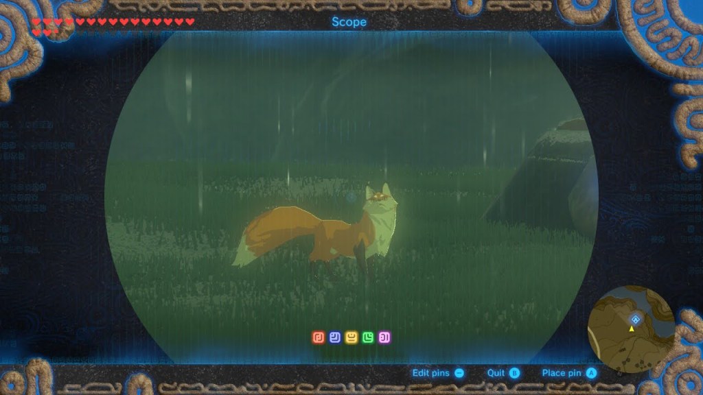
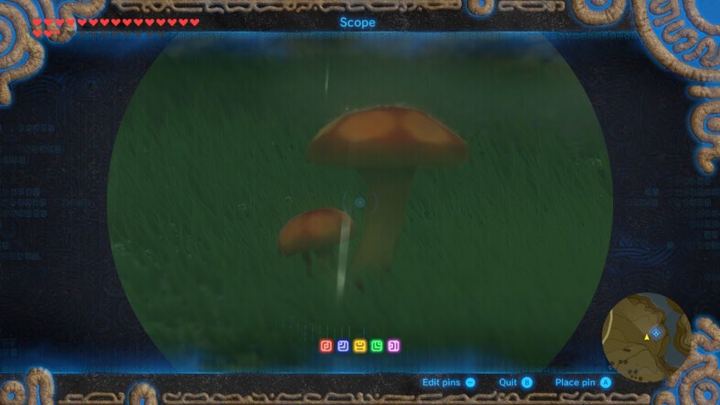


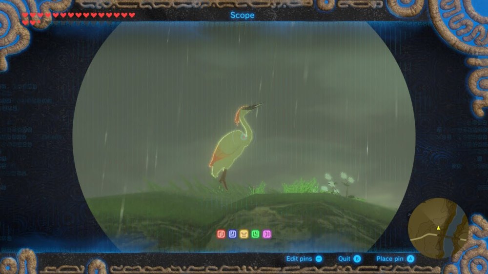
The recent slides and the constant movement of the land from nearby faults creates a highly disturbed region. Therefore we see very few trees and more grasses and mushrooms with are known as primary successors, or the first living things to colonize disturbed land. Lots of wind to transport spores and seeds from mushrooms and flowers gives these organisms a reproductive advantage. As you probably observed from the images, a wet climate is still the norm in this region. Rainy weather allows mosses and algae to cover some of the sedimentary rock formations in the region while birds can feast on insects moving in and out of the wet soil. The ring rocks even act as roosting sites for some birds and give them an excellent view of the rolling plains as they hunt for prey. A slowly running river gives water fowl a distinct advantage for catching fish and insects within the low energy water body. Finally, the fox acts as the predator at the top of the food chain in this region, easily maneuvering the rolling terrain to hunt the birds that dominate the region.
Well, there you have it, the mystery of the ring rocks has been solved! After climbing granitic mountain cliffs and wandering the wet and rolling plains of West Hyrule you are probably ready for a warm meal. As a goron, might I recommend a rock roast? Mining the granite from the Satori Mountains would make a mighty fine rock roast to munch on! But, since rocks aren’t really appetizing to you humans, I have also brought along some Goron Spice. Let’s learn from the birds and catch a fish from the Tamio River, cook it up with some Goron Spice and Hylian Rice which grows abundantly in these grassy hills, and feast on Seafood Curry! You’ll be warm and ready for another Hyrule Geology Tour in no time!
Thank you for reading and stay tuned for the next installment of Hyrule Geology Tours. As always, I would love to hear from you! How did you like the read? What did you learn from it that surprised you? What ideas or suggestions do you have for my next post? I would love your feedback! Also, if you happen to have the game The Legend of Zelda: Breath of the Wild at home, I encourage you to go find these geologic features yourself. The names of all geologic features in this post are actual names from the game so go on the virtual tour for yourself and let me know how it goes!

I’m so excited I found this website! I’m starting college in the fall and am still deciding what I want to do with my life. I liked geology as a kid, but recently found a video of a geologist analyzing botw which reignited my interest. I’ve been looking for more geology x botw content but there are few creators with that niche (shocker lol). So glad I found this! Right now I’m going to major in computer science (which I still love) but I’m having doubts. I feel like it gives me a sense of what geologists look for irl. I need to go back to studying calculus but I can’t wait to explore this website more!
LikeLike
Hey Hannah! Thanks for the reply and I’m happy you enjoy my Zelda x geology content! It is my dream to create full length science courses set up in the world of popular games like Zelda. Games motivated me as a kid and I want people out there to know that you can learn real science by playing games as well! Sorry, I am taking a break from WordPress and blogging while I set up my online courses which is why it took me so long to reply. Speaking of online courses, I do have a Zelda Geology Intro course up and running! I’ll attach the link here, but if you’re interested in looking at it, you can send me your email and I’ll just email you my course content. Keep me posted! https://outschool.com/classes/zelda-geology-tour-an-introduction-to-geology-ngfRkwsS
LikeLike